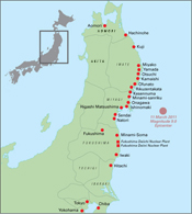
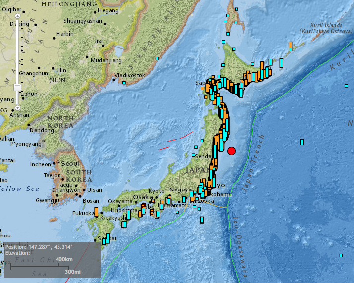
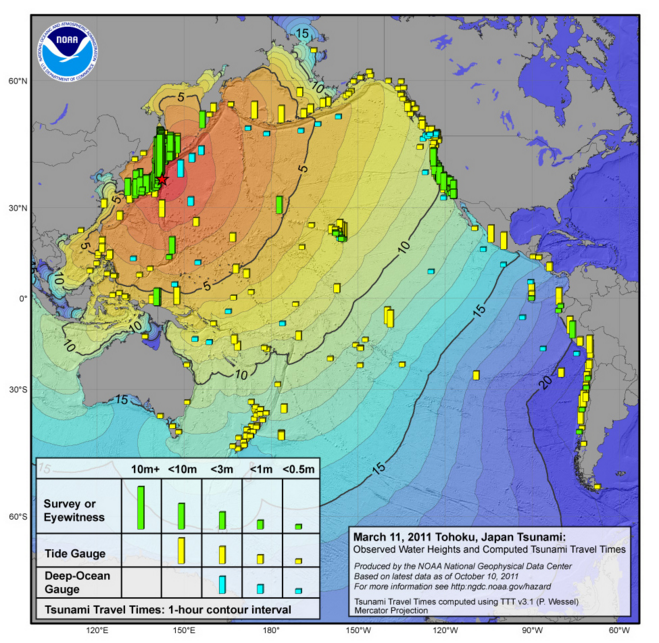
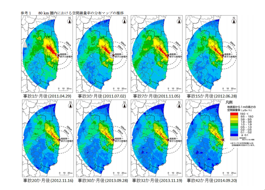
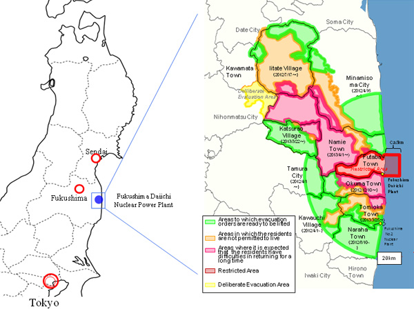
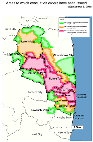
The length of the damaged coastline is 420 miles (670 kilometers), roughly equivalent to the distance from Boston to Washington DC.At their highest point, the tsunami waves reached 131 feet (>40 m), about the height of a 10-story building (US National Oceanic and Atmospheric Administration, https://maps.ngdc.noaa.gov/viewers/hazards/?tsEvent=5413#)This map shows the height and travel time of the tsunami—the tsunami reached the West Coast of the US in about 9 hours, and within 20 hours, it had reached South America (NOAA, https://www.ngdc.noaa.gov/hazard/img/2011_0311.jpg)Distribution of radiation dose around Fukushima Dai-Ichi Nuclear Power Plant, 2011–2014 (Japan Nuclear Regulation Authority, http://radioactivity.nsr.go.jp/ja/contents/11000/10349/24/150213_9th_air.pdf)Fukushima evacuation zones as of March 2013 (Japan Reconstruction Agency, http://www.reconstruction.go.jp/english/topics/2013/03/the-status-in-fukushima.html)Fukushima evacuation zones as of September 2015 (METI, http://www.meti.go.jp/english/earthquake/nuclear/roadmap/pdf/150905MapOfAreas.pdf)